IHCantabria will promote citizen monitoring of Santander’s El Sardinero Beach, through the CoastSnap initiative
Two monitoring stations installed in the “Jardines de Piquío” will allow visitors to record changes on the beach with their mobile phones, helping to raise awareness and conserve coastal environments
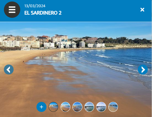
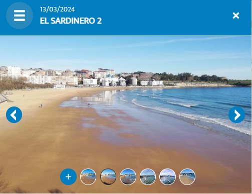
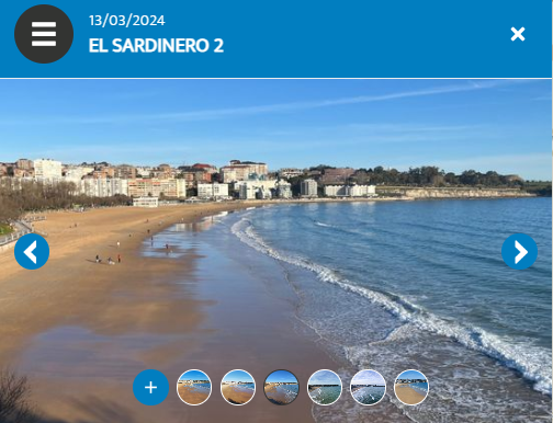
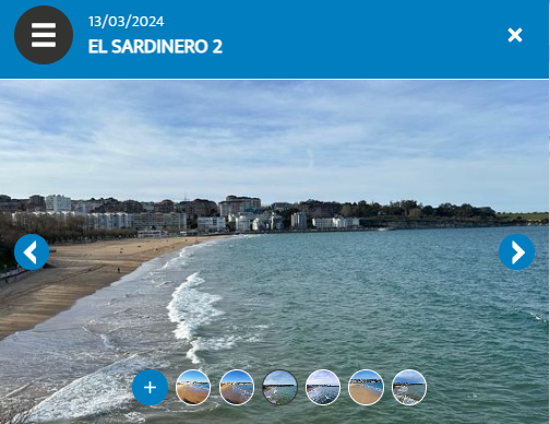
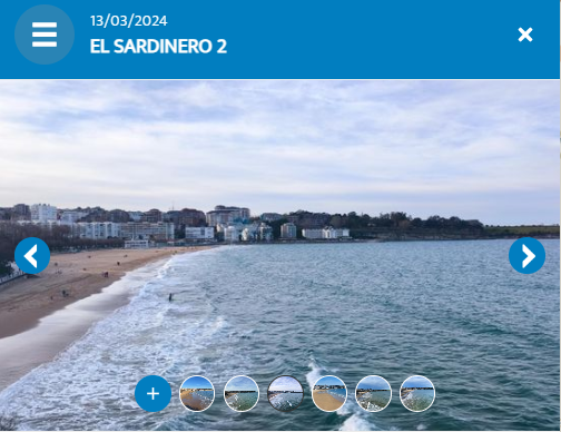
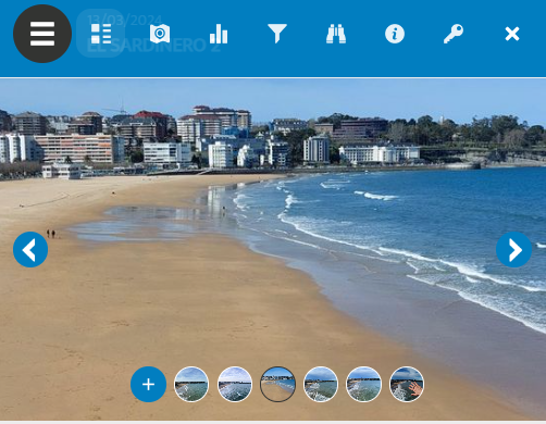
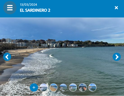
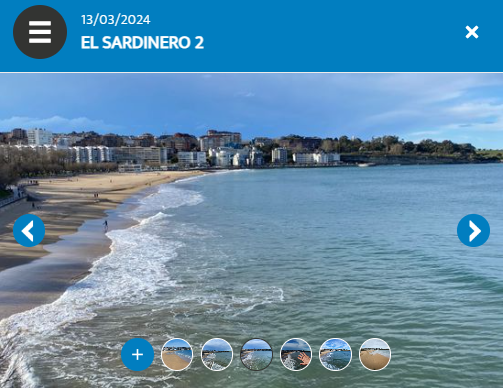
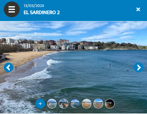
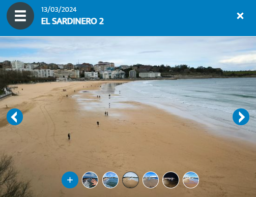
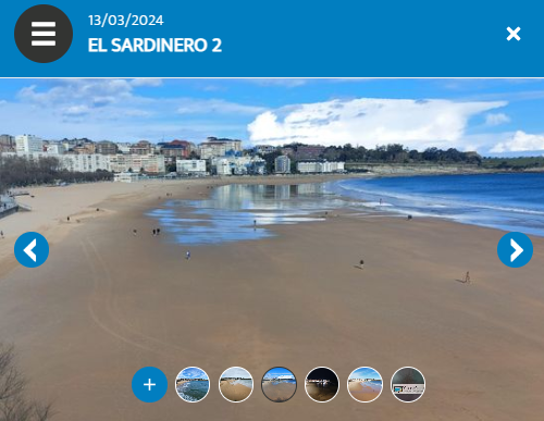
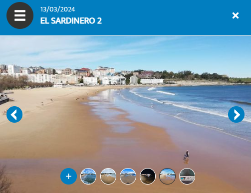
The Environmental Hydraulics Institute of the Universidad de Cantabria(IHCantabria) has inaugurated two CoastSnap monitoring stations in the “Jardines de Piquío”, from which citizens can take photos of the beaches El Sardinero 1 and 2, helping to monitor changes in the coast. With this initiative, Santander becomes part of the global CoastSnap citizen monitoring network, which already has more than 200 stations installed worldwide, including 22 in Spain. This is explained by Camilo Jaramillo Cardona and Paula Gomes da Silva, researchers of the Coastal Engineering and Management Group of IHCantabria, who are promoters of the CoastSnap-El Sardinero initiative.
“CoastSnap is an initiative proposed by researchers at the University of New South Wales (UNSW) in Australia, which seeks to monitor beaches through photos captured with cell phones,” reports Paula Gomes da Silva. The simplicity of the proposed method allows anyone to participate in the monitoring by taking photos from a base installed at a point on the beach and sharing them through the CoastSnap application or social networks. From the photos shared by the community, useful information for coastal management can be obtained, such as the position of the coastline and its changes over time. However, the greatest benefit of this initiative lies in raising awareness and citizen participation in monitoring the beaches, as well as promoting local and international tourism by publicizing the beaches on social networks.
Currently, there are several coastal cities around the world participating in the initiative and Spain already has CoastSnap monitoring bases in Galicia, Catalonia, Valencia, the Balearic Islands and Andalusia. In Spain, the participants in the initiative have created the group “Centinelas de la Costa” (Sentinels of the Coast), with the aim of disseminating the images, encouraging citizens to take photos and joining forces when working with the data obtained from them.
By joining the global citizen monitoring network CoastSnap, IHCantabria promotes the inclusion of Santander in this group of cities that support the monitoring and preservation of the coast, while meeting the objectives of the Marine Science Program (PCM, by its acronym in Spanish), which is part of the Complementary Plan for R+D+i in Marine Sciences, ThinkInAzul, which is financed with funds from the European Union NextGenerationEU/PRTR (C17.I1) / MICIU / Gob.Cantabria. The PCM is made up of 15 projects to be executed between 2022 and 2025, within the framework of the Complementary Marine Science Plan promoted by the Ministry of Science and Innovation (MCIN). One of the objectives of the PCM is to promote the observation and monitoring of the marine and coastal environment, through various means, to achieve a better assessment and mitigation of the impact of climate change on the coasts. Another objective is to promote citizen participation, to raise awareness among the local community and tourists about the importance of preserving the beaches and their environment. Therefore, the application of CoastSnap in Santander is perfectly aligned with the objectives of the PCM.
CoastSnap El Sardinero is an initiative led by the IH-SET “Shoreline Evolution Tools” and AutoCos “Coastal Machine Learning” projects (both part of the PCM), which are led by the Coastal Engineering and Management Group of IHCantabria.
How to participate in this citizens’ initiative?
To participate in this citizens’ initiative, users have to follow the two steps detailed on the information posters located at each station. “First, they have to take a snapshot of the coastline with the smartphone from the designated camera cradle located at the top of the monitoring station; then they will have to send it, through the corresponding QR code that connects to the CoastSnap application, where the photographic record is stored,” explains Camilo Jaramillo Cardona.
Submitting the photo is a simple process. When accessing the QR code, a screen will open asking for the selection of the captured photo (without zoom and in horizontal format). The CoastSnap application will automatically recognize the image file metadata, such as date and time of capture. Then, it will be required to indicate the perception of beach changes since the last reference, whether it is accreated, eroded or stable. In addition, advanced options are provided to specify whether the photo was taken instantaneously or long exposure, as well as to describe the sea level at the time of capture (low tide, rising tide, high tide or falling tide). There is also an opportunity to add a comment. Finally, the save option is selected to store the data in the application. It is essential to complete all the fields in the CoastSnap application in order to upload the photo correctly.
More information on the CoastSnap initiative can be obtained through the following link: www.coastsnap.com.

Camilo Jaramillo Cardona and Paula Gomes da Silva, researchers of the Coastal Engineering and Management Group of IHCantabria, lead the CoastSnap-El Sardinero initiative.

To participate in this citizen initiative, please follow the steps detailed on the information posters located at each station.
13
12
11
10
9
8
7
6
5
4
3

2
1