A workshop on the characterization of riparian vegetation addressed key challenges for the management of river ecosystems, at IHCantabria

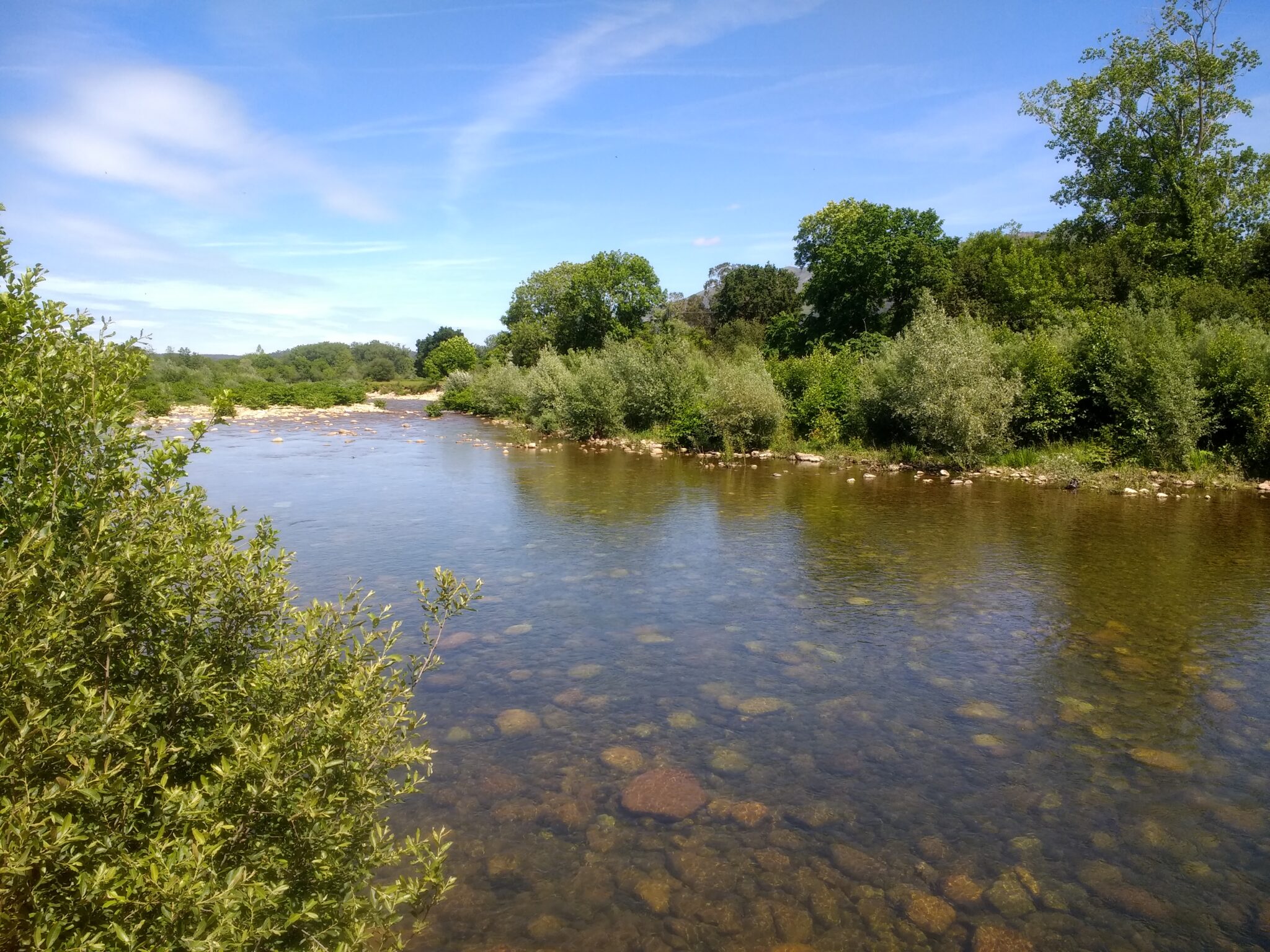
Riverside area on the Saja River, near the town of Terán (Cantabria), with willow and alder trees.
The objectives of this workshop were to identify the needs of the public administration in the management and assessment of riparian vegetation, to review existing methodologies at different scales and to detect knowledge gaps in order to propose improvements through the use of remote sensing.
The Institute of Environmental Hydraulics of the University of Cantabria(IHCantabria) held a workshop entitled “Needs and methodologies for the characterization of riparian vegetation” on September 19.
This event brought together more than 25 experts and professionals in environmental management, public administration and scientific organizations.
This workshop, held in online mode and lasting three hours, was part of the European Cop.RIVER project.
It was organized in order to identify the needs of the public administration in relation to the management and characterization of riparian vegetation, as well as to discuss current and future methodologies in this area that include the use of remote sensing.
The welcoming remarks were given by the head of the Continental Ecosystems Group of IHCantabria, José Barquín Ortiz, together with the researcher Laura Concostrina Zubiri, member of the same group.
Both reported on the objective and some relevant results of the Cop.RIVER project.
Characteristics of the Cop.RIVER project and the workshop held at IHCantabria
This project, which runs from 2022 to 2025, proposes to evaluate COPERNICUS tools for monitoring the effects of global change on rivers and riparian zones. The main objective is to identify needs in monitoring riparian habitats and to evaluate the applicability of remote sensing tools provided by the European Space Agency (ESA) COPERNICUS program.
During the workshop, held on September 19, important issues on the needs and methodologies for the characterization of riparian vegetation were addressed.
Francisco Javier Monte, representing the General Directorate of Water (DGA) of the Ministry for Ecological Transition and Demographic Challenge (MITECO), presented a detailed analysis on the “Needs of the DGA for the assessment and monitoring of river ecosystems”.
This intervention underlined the relevance of having accurate and updated information for decision making in the management of these ecosystems.
François Tapia, from TRAGSATEC’s Natural Environment Department, and Juan Antonio Calleja, researcher at the Autonomous University of Madrid, representing the General Directorate of Biodiversity, Forests and Desertification (MITECO), presented the “Official procedures for the monitoring and evaluation of the conservation status of riparian forests and scrublands in Spain”, detailing the official methods for diagnosing the conservation status of these habitats and the challenges involved.
Patricia Rodríguez González, researcher at the Centro de Estudos Florestais e Laboratório Associado TERRA, University of Lisbon, offered the academic perspective on “Challenges, opportunities and experiences in riparian vegetation research and management”.
Patricia Rodriguez stressed the importance of integrating research into the active management of these ecosystems, highlighting the need to assess the biotic and abiotic aspects that influence river ecosystems at multiple spatial and temporal scales.
A fundamental contribution was offered by researcher Álvaro Fernández Menéndez, from the Continental Ecosystems Group of IHCantabria, who presented advances in his research on the “Dynamics of riparian zones and modeling of their vegetation composition”, a novel approach to characterize changes in riparian ecosystems using remote sensing.
Before starting the round of questions, comments and conclusions, Laura Concostrina Zubiri and Fernando Rodríguez Montoya, also from IHCantabria, presented the “Development of a tool for the selection and application of indicators of the state of conservation of riverbanks”.
The tool they referred to is one of the results of the Cop.RIVER project and will be of great help to environmental managers, because it will provide information for remote sensing to develop more effective riparian ecosystem management strategies in a context of global change.
The Cop.RIVER initiative, part of the Copernicus User Framework Program, will continue to make progress in the search for remote sensing-based solutions to characterize these habitats and ensure the conservation of their biodiversity and the functions they perform.

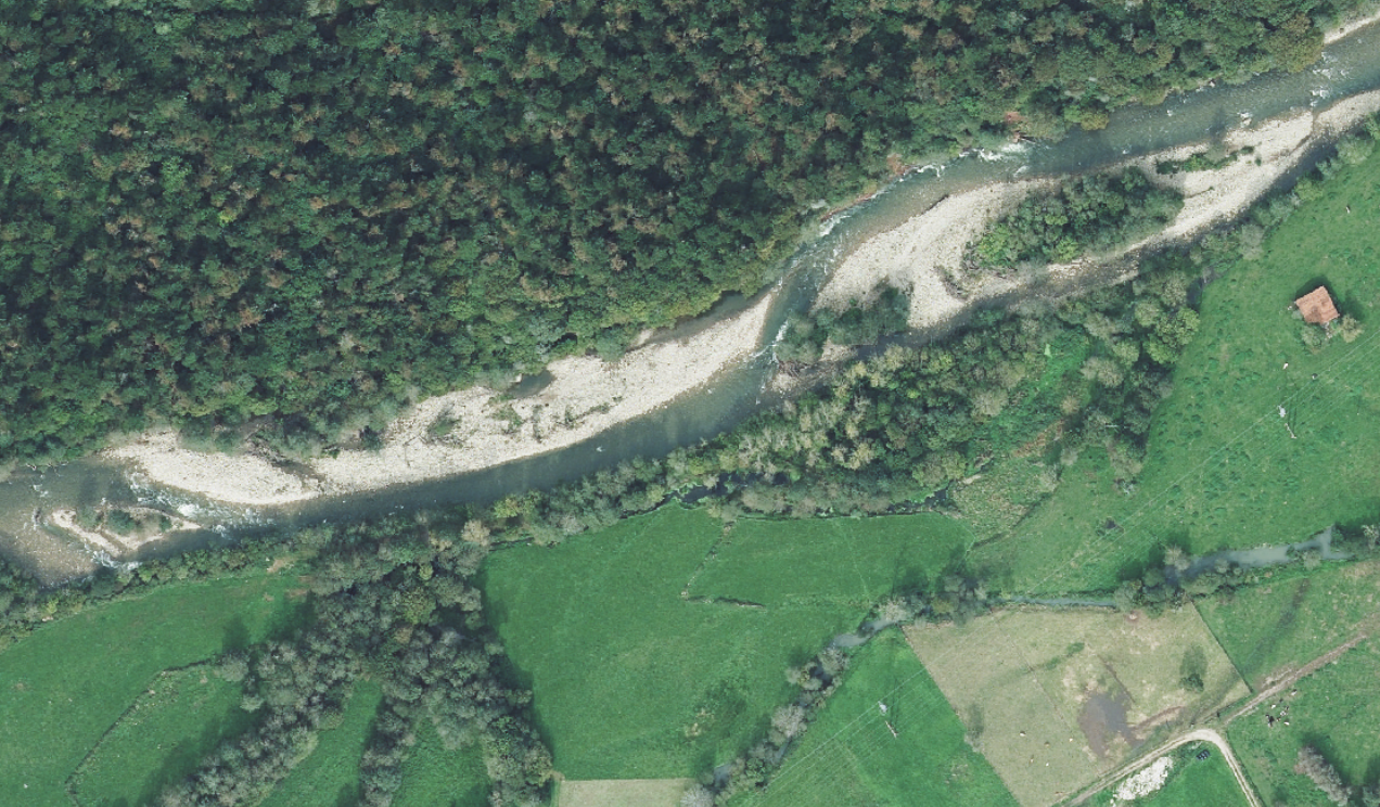
Aerial view of the riparian vegetation in the Saja River, near the town of Ruente, in Cantabria..
Fuente: PNOA, 2020
This project is implemented with funding from:


