Tracking and monitoring the coast
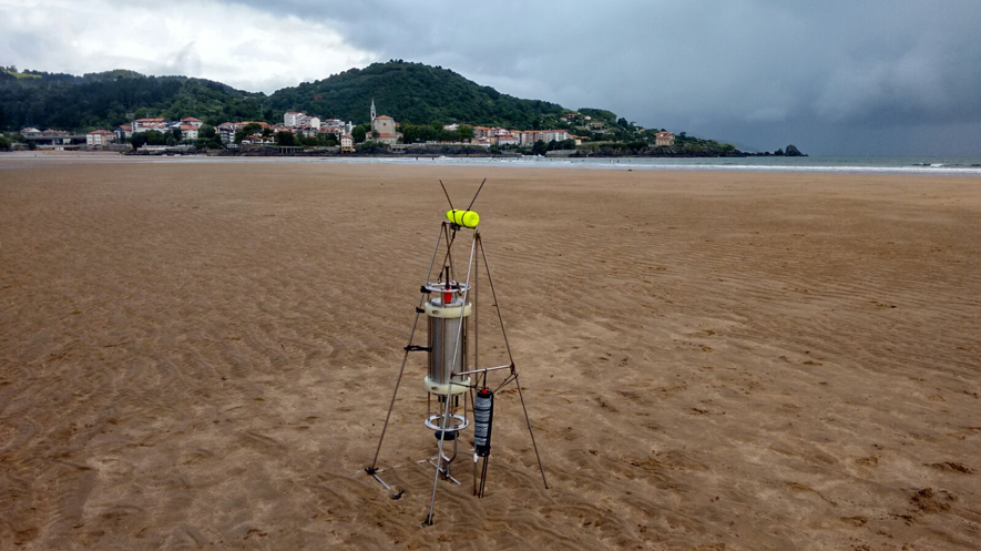
The tracking and monitoring of the coast is essential to know its evolution in the face of acting dynamics or human interventions, in order to facilitate coastal management and decision making.
At IHCantabria we have extensive experience in the design and implementation of all types of monitoring campaigns in coastal areas which, together with the physical and numerical models and the multidisciplinary nature of its human capital, give us an integral knowledge of the processes and dynamics that govern these environments.
We have a wide range of monitoring systems at IHCantabria, both the standard methods of in situ measurements for carrying out field campaigns (GPS, pressure and kinematic sensors, taking and analysis of water column samples, etc), and the video-monitoring systems in real time (HORUS or IH-BeachCam system) or the use of teledetection.
The implementation of these high spatial-temporal resolution monitoring systems has served for the development of methodologies and numerical algorithms that allow the definition of indicators to analyze coastal meteoceanographic variables or to control water quality (e.g., water quality). industrial and urban spills); solving problems of safety management in navigation or in access channels to ports; analysing the stability of dykes and port structures; understanding and protecting beaches and dunes from possible erosion and/or flooding processes; evaluating the impact of dredging or construction works; or even analysing/managing the use of the beach for tourist purposes by evaluating the different uses of the beach or the distribution and density of users on it.
Methodology
We develop new analysis and design technologies based on modeling without scale effects.
We maintain monitoring and warning systems (e.g. spills, industrial and urban spills in coastal areas).
We investigate coastal processes through the monitoring of morphodynamic variables, in order to understand their functioning and be able to address coastal problems such as erosion or flooding.
We monitor coastal actions or structures throughout their useful life or during their execution, with the aim of establishing whether corrective measures are necessary.
We develop and implementation of tools for the exploitation and management of coastal zone uses (e.g. distribution and density of users on a beach, dredging of a navigation channel).
We compile real case data for the calibration and validation of numerical models and methodologies to be developed in order to analyze coastal processes (flood models, morphodynamic evolution).
AREAS OF EXPERTISE
Management and operation of buoys and coastal sensors
Maritime climate analysis.
Water quality control.
Design of monitoring programs for coastal structures or environments
Video cameras.
Field campaigns.
Execution, processing and analysis of field campaigns
Meteo-oceanographic variables.
Sediments.
Design and implementation of port or coastal management systems based on video images
Dredging.
Beach uses.
Monitoring the evolution of the coastline.
Analysis of the morphodynamic evolution of beaches or estuaries
Beaches:bars, return currents and dunes.
Estuaries: low tides.
Based on images: video cameras or satellite, coastlines or topo-bathymetric surveys.
Design and implementation of plans to track the actions planned for the coast
PARTNERSHIPs
IHCantabria has carried out projects as part of competitive tenders in Spain (SMC2020) and Europe (COASTVIEW), and has been involved in cooperation and transfer projects in several countries around the world, including Colombia (Cartagena-Cam, HORUS).
These kinds of projects have contributed greatly to our knowledge of coastal processes and to the development of methodologies and tools to study and monitor coastal environments. A clear example is the European project COASTVIEW, where practical applications were developed to monitor the evolution of the coastline, operational systems or systems to monitor the evolution of port access channels, making it possible to determine the need to dredge in order to ensure navigational safety. The scientific rigor and quality of the results obtained in this project led to the publication of a special edition in Coastal Engineering titled The CoastView Project: Developing coastal video monitoring systems in support of coastal zone management.
SIGNIFICANT PROJECTS
HORUS
HORUS is an environmental video monitoring system created to help research and manage the environment. It is capable of continuously quantifying changes in various natural areas, and offers great spatio-temporal resolution.
IHCantabria has installed the system throughout the water cycle: rivers, estuaries and coast. The images generated are also practical for users of these environments by displaying hydraulic and climatic conditions of relevance to the practice of their activities.
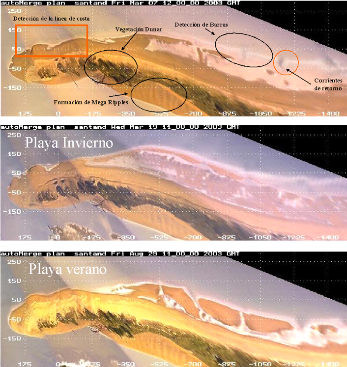
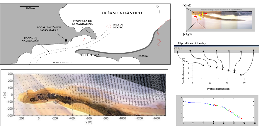
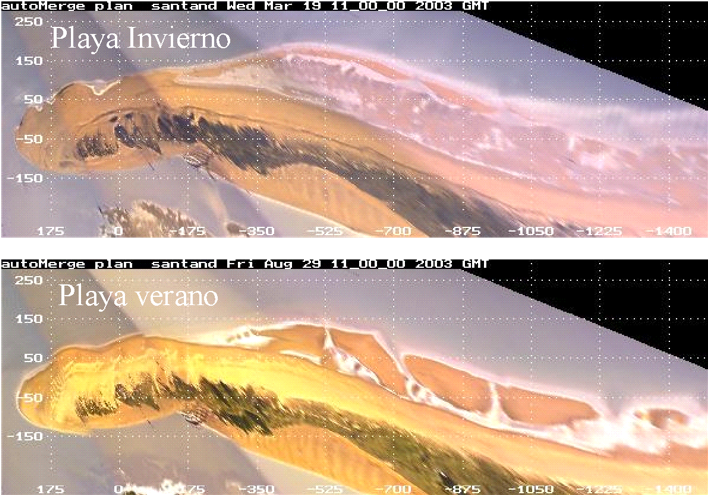
COASTVIEW:STUDY OF THE EVOLUTION OF THE EL PUNTAL BEACH (2002- 2011)
Monitoring of the morphodynamic evolution of the El Puntal in Santander through the advanced processing of video camera images.
This project is part of the European COASTVIEW project (2002-2005), which aimed to show the utility of these systems to coastal management and to understanding morphodynamic processes on the coast.
RED VIGÍA
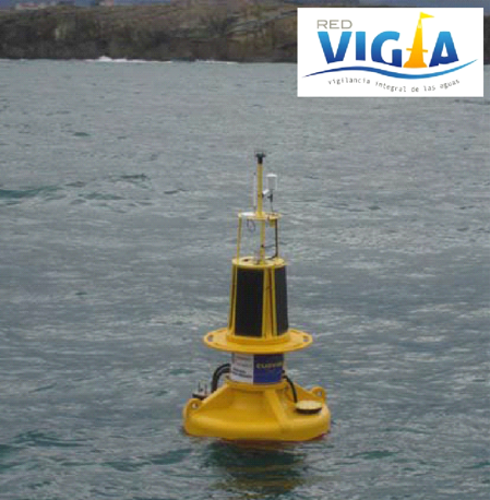
Development and management of a maritime climate and water quality monitoring system. The Red Vigía system, active from November 2006 to 2016 and run by the Government of Cantabria, was designed to comply with the monitoring programs established by the Water Framework Directive, whose purpose was to achieve a “good ecological status” for all the bodies of water in the European Union by 2015.
The information obtained in Virgen de Mar and Santoña supplements the quarterly field campaigns organized since 2005 by the Regional Ministry of the Environment within the Quality Control Network of the Cantabrian Coast, which allowed for properly planning and managing the water bodies in the region.
STUDY OF THE EVOLUTION OF THE EL PRAT BEACH (2012-2013)
Analysis of the evolution of the stretch of coastline between the Port of Barcelona and Port Ginesta, including an evaluation of transport rates in that section. This study is part of the action and monitoring plan that the Port Authority of Barcelona must carry out as a consequence of the work to expand the port, in accordance with the provisions of the Environmental Impact Statement (EIA, Official Journal of Spain, July 2000).
PLAYA LAIDA (2015)
Follow-up in the field and numerical modeling of the Laida beach in order to undertake potential recovery actions by the summer of 2015. The project required a diagnosis of the beach after the winter storms of 2014, and an understand of the operation of the sedimentary system, as well as of the influence of the anthropic actions that may have altered its functioning.
SOFTWARE & TOOLS
IH – BEACHCAM
System of videocameras installed in several beaches on the Cantabrian coast, specifically in El Sardinero, Magdalena and El Puntal de Santander. Additionally, a series of methodologies and algorithms were developed to process the images and analyze data in order to understand the dynamics of these beaches and their response to the natural variability in the maritime climate (seasonal, interannual, extreme events, etc.) or anthropic activity (dredging, reclamation, construction of breakwaters, etc.).
These data are also very useful for calibrating and validating models and methodologies developed at IHCantabria, such as those developed as part of the SMC2020 project (flooding model by Gomes et al., 2018, CHRONOS evolution model, etc.).
LET’S TALK.
Would you like to know how we can help you?
Send me a message. I will get back to you as soon as possible
LET’S TALK.
Would you like to know how we can help you?
Send me a message. I will get back to you as soon as possible
OMAR QUETZALCÓATL
Researcher || Expert in Monitoring
We advise you that your personal data will be processed by FUNDACIÓN INSTITUTO HIDRÁULICA AMBIENTAL DE CANTABRIA, in order to manage your request and maintain professional and commercial relations with you. Your data will not be transferred to third parties. This data treatment is necessary to attend your request. Your data will be kept until you unsubscribe from the service and/or after a reasonable time has passed since we attended to your request. You can exercise your rights of access, rectification, cancellation, opposition, portability and limitation of the processing of your data by contacting the FUNDACIÓN INSTITUTO HIDRÁULICA AMBIENTAL DE CANTABRIA, PCTCAN C/ISABEL TORRES, 15, 39011 SANTANDER (CANTABRIA), or rgpdihcantabria@unican.es with a copy of your ID card duly accrediting your identity. In any situation, you have the right to file a complaint with the Spanish Data Protection Agency (AEPD)
