
Modeling and Analysis of Meteoceanographic Data
Data on meteoceanographic variables are necessary for a multitude of applications (engineering work, territorial management, risk assessment, among others). The data can come from measured observations or be generated through the use of numerical models. Both data sources, however, require a preliminary analysis (e.g. quality control of measurements, analysis of the model’s sensitivity, validation of simulated data).
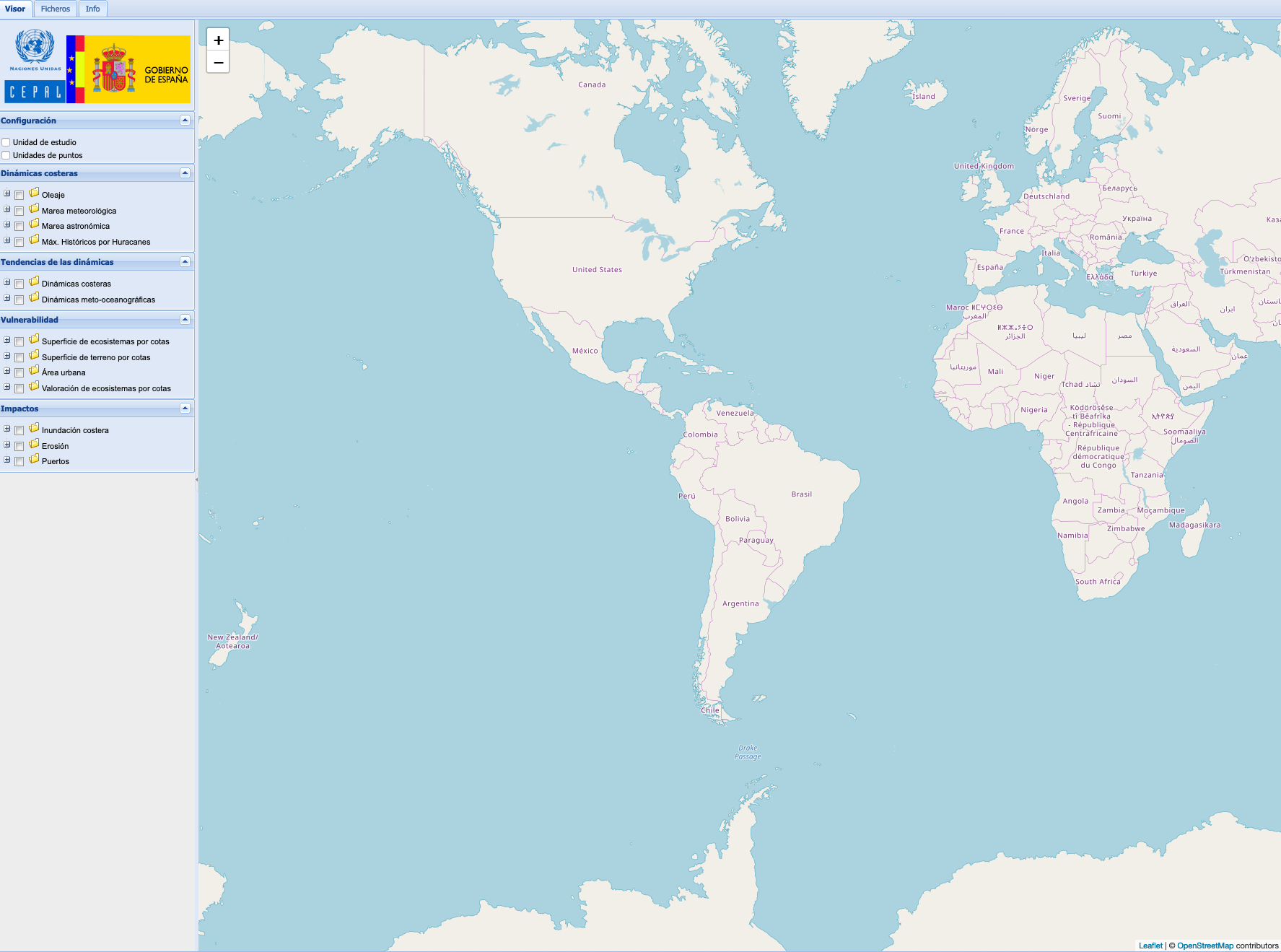
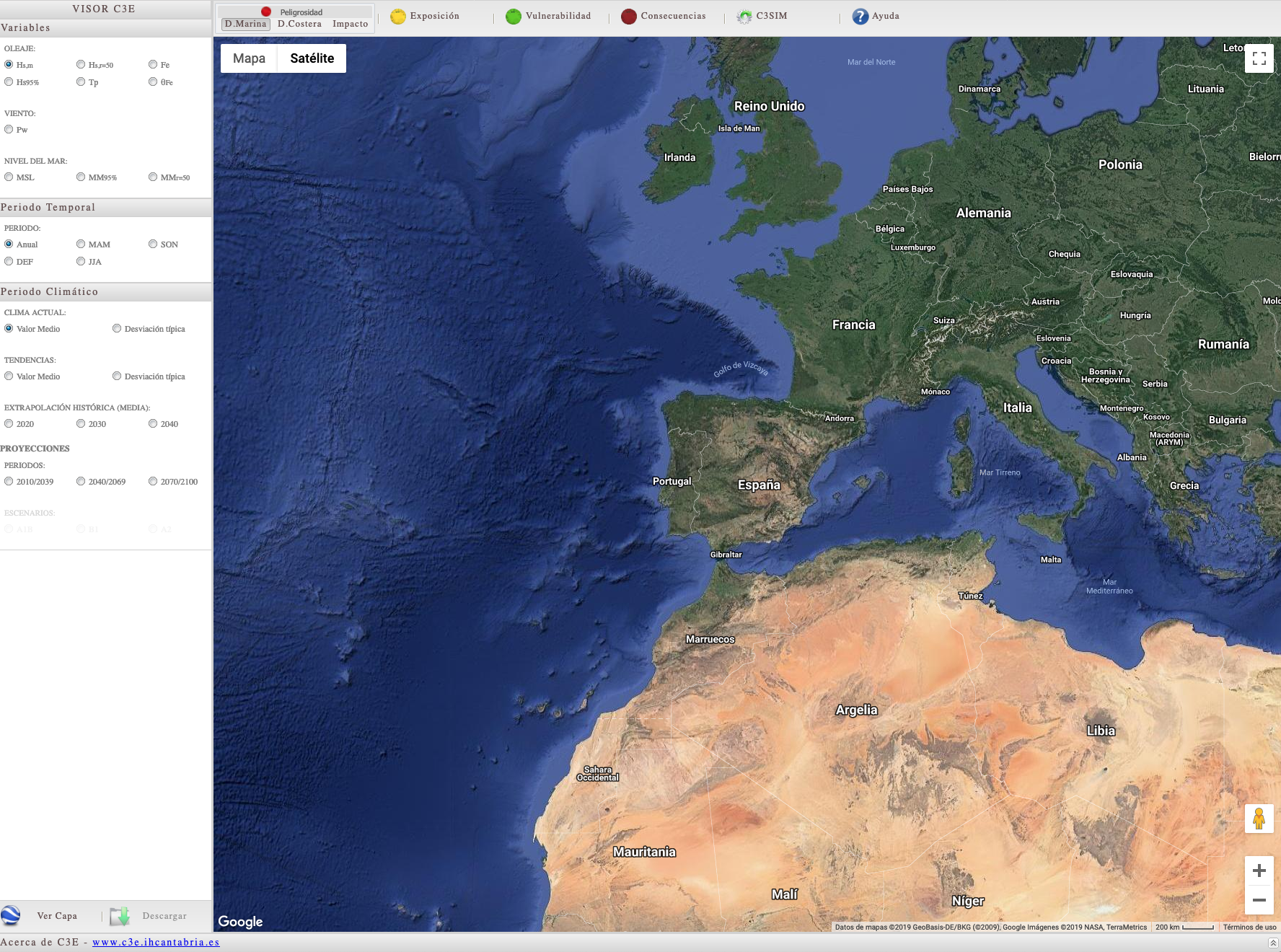
At IHCantabria, we develop methodologies to generate meteoceanographic databases on global, regional and local scales, with a high spatial and temporal resolution. The databases can provide historical information on current (nowcast, forecast) and future (climate projections) climate. In general, the databases developed cover time periods of at least 30 years and have an hourly resolution, which allows them to be used for climate characterization studies.
At IHCantabria we have extensive experience in the development of met-oceanic databases, and specifically for the wave, sea level, marine current, wind, and flow rate variables. For its models, it always reviews and employs state-of-the-art models, which are then customized for the specific application. In addition, the simulated databases are always validated through observations. All the information involving the meteoceanographic data generated is always documented through technical reports or scientific publications.
Methodology
COMPILATION OF DATABASES
The generation of oceanographic data requires an analysis in the study area of the available measurement instruments (in-situ or remote), bathymetry, orography, coastline, previous databases, among others. This information is essential to design the method to be used to generate new data.
Numerical modeling
In most cases, numerical models are required to develop databases. We work with the most widely used, state-of-the-art numerical models in the scientific community (e.g. atmospheric, hydrodynamic). The selection and configuration of the model is conditioned by the requirements (e.g. spatial resolution, 3D modeling) of the target database product.
Data validation
Whenever meteoceanographic conditions are simulated, it is necessary to evaluate the reliability and quality of the data generated to represent both average and extreme conditions. Because of this, we have developed specific statistical methodologies to validate, and also to correct, simulated databases.
AREAS OF EXPERTISE
Numerical modeling of atmospheric conditions.
We use regional models with the specific goal of reconstructing the meteorological conditions in the lower part of the troposphere (first 250 meters of altitude). We specialize in simulating atmospheric conditions on the coast and in marine environments.
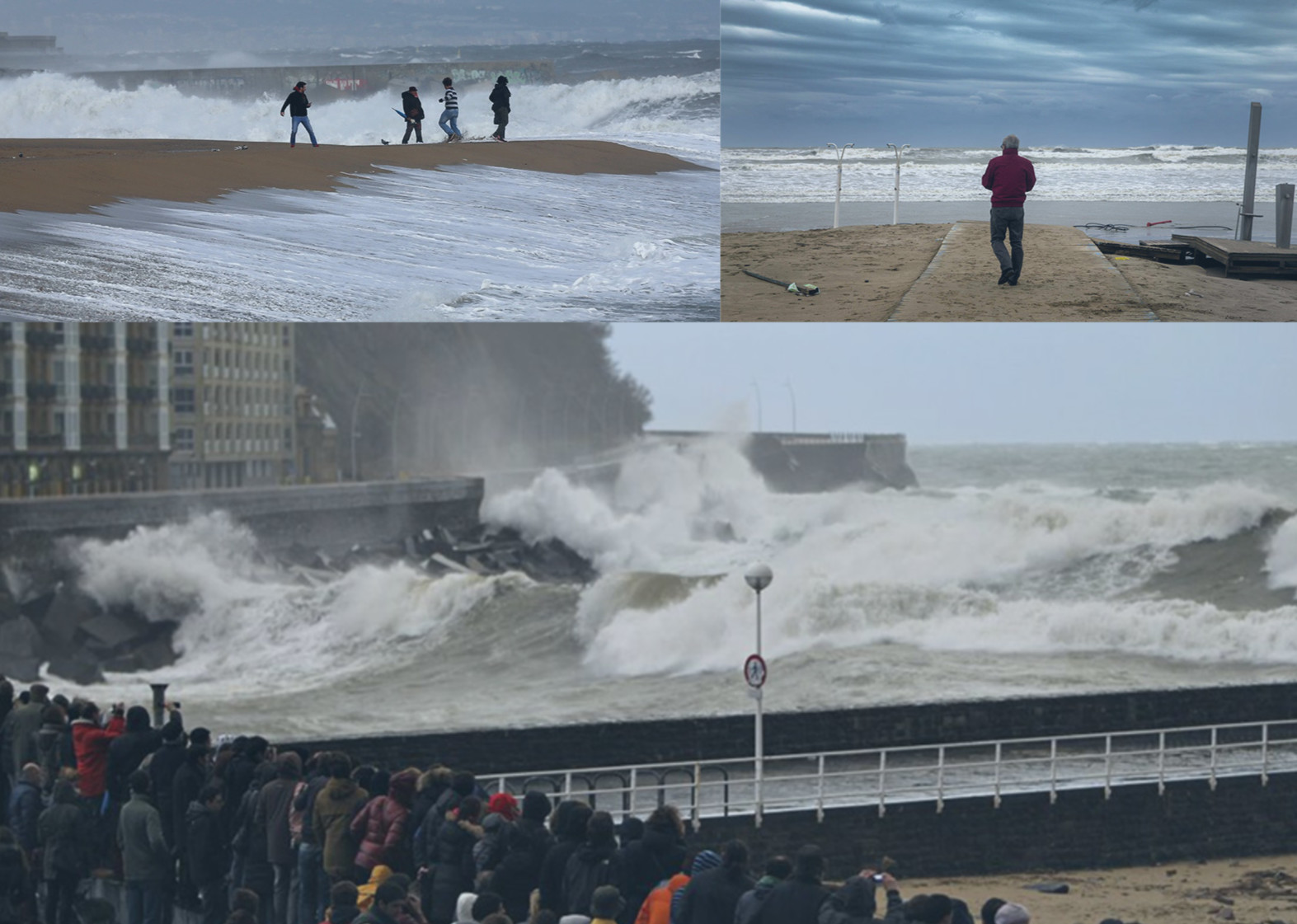
Numerical modeling of wave conditions.
On a global, regional and local scale. Different wave generation and propagation models are used for this purpose. This modeling includes the simulation of waves in open waters, the propagation and dissipation of waves in the area near shore where they break, or the specific simulation of extreme events (ocean storms, hurricanes).
Numerical modeling of sea level conditions.
Sea level variations require knowledge of the contributions from different components (e.g. astronomical tide, changes in the level due to atmospheric or oceanographic agents). Various regional hydrodynamic models are used to reconstruct these marine dynamics.
SIGNIFICANT PROJECTS
MANAGEMENT OF COASTAL FLOODING RISKS IN THE STATE OF SANTA CATARINA, BRAZIL
The scope of this project involves the generation of databases of met-oceanic dynamics, both historical and for projected climate change scenarios, and the development and application of a methodology to conduct high-resolution studies of flood impacts in a section of the coast of Santa Catarina, Brazil.
METEOROLOGICAL TIDE MODELS TO ANALYZE THE FLOOD RISK ON THE EAST COAST OF THE UNITED STATES (GUY CARPENTER, 2018)
The objective of this work is to analyze the sensitivity of the flood heights obtained when simulating hurricanes Wilma, in October of 2005, and Irma, in September of 2017, to different numerical configurations of the ADCIRC + SWAN model and to the input parameters (forcings, bathymetry, friction with the bottom, etc.). The study area is centered on the southwest of the Florida peninsula, with a special focus on the coasts of Sarasota, Charlotte, Lee, Collier and Monroe counties. The results obtained are part of the hurricane flooding archive produced by different centers, which allows the client to optimize their investments.
Analysis of resources for offshore wind farms in Europe and the United States
We have worked for different electric utilities in order to generate and analyze information on ocean winds at offshore wind farms in any of their phases (pre-design, construction, maintenance, etc.). This requires generating high-resolution historical databases of atmospheric and marine variables for target offshore areas, validating them with onsite measurements and a statistical analysis conducted as per international standards. The study areas include the North Sea, the French and the Spanish Atlantic coasts, and the northern states of the US west coast, among others.
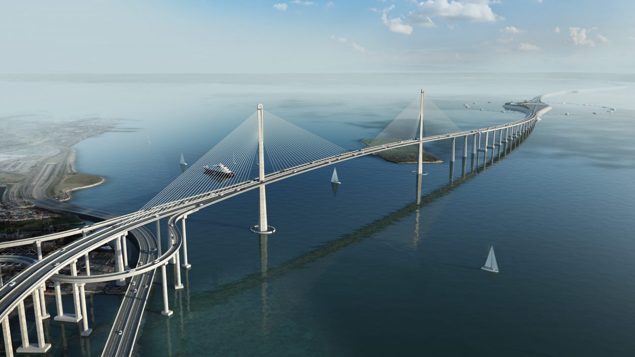
STUDY OF TYPHOONS AND TSUNAMIS FOR THE CEBU – CORDOVA LINK EXPRESSWAY, PHILIPPINES (SENER, 2018)
The goal of this work is to provide design parameters on wind, waves and storm surges caused by tropical cyclones for detailed engineering studies of the Cebu-Cordova Link Expressway. This required using a probabilistic approach based on the generation of thousands of synthetic cyclones, the wind and pressure fields from which were used to force coupled hydrodynamic and wave models. The approach used allowed us to solve the complex interactions between waves, sea level and currents, which is essential for properly determining the design sea levels and waves for this important infrastructure.
Analysis of resources for offshore wind farms in Europe and the United States
We have worked for different electric utilities in order to generate and analyze information on ocean winds at offshore wind farms in any of their phases (pre-design, construction, maintenance, etc.). This requires generating high-resolution historical databases of atmospheric and marine variables for target offshore areas, validating them with onsite measurements and a statistical analysis conducted as per international standards. The study areas include the North Sea, the French and the Spanish Atlantic coasts, and the northern states of the US west coast, among others.
STUDY OF TYPHOONS AND TSUNAMIS FOR THE CEBU – CORDOVA LINK EXPRESSWAY, PHILIPPINES (SENER, 2018)
The goal of this work is to provide design parameters on wind, waves and storm surges caused by tropical cyclones for detailed engineering studies of the Cebu-Cordova Link Expressway. This required using a probabilistic approach based on the generation of thousands of synthetic cyclones, the wind and pressure fields from which were used to force coupled hydrodynamic and wave models. The approach used allowed us to solve the complex interactions between waves, sea level and currents, which is essential for properly determining the design sea levels and waves for this important infrastructure.
LET´S TALK
Would you like to know how we can help you?
Send me a message. I will get back to you as soon as possible
LET´S TALK
Would you like to know how we can help you?
Send me a message. I will get back to you as soon as possible

MELISA MENÉNDEZ GARCÍA
Researcher || Expert in Climate Characterization
We advise you that your personal data will be processed by FUNDACIÓN INSTITUTO HIDRÁULICA AMBIENTAL DE CANTABRIA, in order to manage your request and maintain professional and commercial relations with you. Your data will not be transferred to third parties. This data treatment is necessary to attend your request. Your data will be kept until you unsubscribe from the service and/or after a reasonable time has passed since we attended to your request. You can exercise your rights of access, rectification, cancellation, opposition, portability and limitation of the processing of your data by contacting the FUNDACIÓN INSTITUTO HIDRÁULICA AMBIENTAL DE CANTABRIA, PCTCAN C/ISABEL TORRES, 15, 39011 SANTANDER (CANTABRIA), or rgpdihcantabria@unican.es with a copy of your ID card duly accrediting your identity. In any situation, you have the right to file a complaint with the Spanish Data Protection Agency (AEPD)